“It cannot be many years before this primeval part of the city at the northern end of Manhattan Island will be submerged like the rest with the flood of tenement houses that has inundated the undulating fields of the Dyckman Valley.” -New York Free Press, August 7, 1910

Every year or so a major publication proclaims that Inwood is the “next new neighborhood,” an “undiscovered secret,” or the next “it” place to live.
And, with every new news report, residents of Inwood discuss what changes these newcomers might bring.
But, if old news-clippings are to be believed, the story of Inwood’s takeover by outsiders is as old as the tale of the greatest real estate swindle in history, which, according to legend, happened right here in Inwood Hill Park.
For example…
A recent New York Times article reported, “Though there were those who demurred, a number of residents described the neighborhood as a hidden gem—as if an area with more than 41,000 residents could be kept a secret.”

Time-Out NY went so far as to call Inwood “the next Park Slope.”
A 2008 article in the New York Daily News wrote. “Inwood hasn’t even begun to see how popular it can become among the young and cool crowd.” Inwood, the scribe reported, was well on its way to becoming a “hipster” paradise.
Skipping back a full decade, the 1995 “Best of Manhattan” column in the NYPress opined, “The residents of Inwood will probably kill us for letting the cat out of the bag and exposing them to the dangers of yuppification, but there are still large one-bedroom apartments in this pretty neighborhood at the northern tip of Manhattan Island that are easily affordable, even by those with artistic pretensions.”
A 1990’s Yuppie takeover followed by a millennial hipster invasion?
The following account, published a century ago, lays bare the fears of those who came before us—a fear of outsiders treading on this beloved “forbidden territory.”

The New York Free Press
August 7, 1910
AT THE OTHER END OF MANHATTAN ISLAND
“Everybody knows what the towered sea front of the lower end of Manhattan Island looks like. Many thousands of words of poetry, fiction, and picturesque description have been employed in trying to put on paper every aspect of its beauty. Great painters have covered yards of canvas in trying to catch its mystic, elusive charm as see from the sea or when it is looked at down the vistas of its great architectural canyons. But probably not one New Yorker in ten thousand knows anything about the extreme northerly end of Manhattan, where trees 400 years old crown Indian shell heaps, and where there still remains a bit of the primeval forest that Hendrik Hudson and his sailors first gazed upon.

At the lower end of Manhattan the pavements throb with life and the cars and trucks rattle and roar all day long. At the northern end there are no city streets. No public highways lead to it from the outside world. To the west is the Hudson River, to the north the Harlem Ship Canal and to the east and south sunny fields and the bluff of Fort Washington.

To all except a few it is a forbidden territory on account of its remoteness and because it is still private property. The few residences that are scattered about may be reached by two private driveways, Upper Bolton Road and Lower Bolton Road. Prescott Avenue, which extends north of Dyckman Street, some distance from the Hudson River, stops at the top of some rising ground as though exhausted by the climb and continues as a narrow and torturous footpath that winds downward through a deep cleft in the northern face of Inwood Hill and gradually ravels out into a network of faint trails. One of these leads to the bend in old Spuyten Duyvil Creek at what is known as Cold Spring Hollow.

The two Bolton Roads were partially constructed by John and Curtis Bolton nearly a century ago. The property owners on the hill keep them in repair and provide their own water supply and their own private gas lighting. The public is not welcome at the northern tip of Manhattan Island, and it is discouraged from entering the Bolton Roads by signs that begin with “No Trespassing” and end with “Beware of the Dog.” Few uninvited visitors have found out whether there is a dog to beware of or not. Probably there are several friendly, well-fed pets who live there and hold down pleasant jobs of watching their master’s properties.

These roadways are overarched by great trees that never have known the touch of an ax or tripping saw. Here and there in narrow clearings are comfortable residences with smooth, terraced lawns, dropping gently to the river’s shore. Squirrels frisk about undisturbed and birds carol all day long.
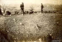
On the northern shoulder of Inwood Hill are the ruins of Cock Hill Fort. This was a redoubt that sheltered the British troops in 1776. Along the high cliffs even today may be seen great mounds of oyster shells that are the relics of meals eaten by the original owners of Manhattan centuries ago. At the base of the cliff is a spring from which a brook meanders down the bend in old Spuyten Duyvil Creek at “No Man’s Island.” In a tiny triangle of meadowland at the junction of the brook and the larger stream is the only building within sight—a small boathouse. A crooked trail leads to Prescott Avenue (now Payson Avenue) and the outside world of dusty, paved streets, clanging trolley cars and the crowded trains of the Subway.

It cannot be many years before this primeval part of the city at the Northern end of Manhattan Island will be submerged like the rest with the flood of tenement houses that has inundated the undulating fields of the Dyckman Valley. The future of Inwood Hill probably will be decided by two great improvements that the city is planning. One of these is the extension of Riverside Drive and the other the building of the Henry Hudson Memorial Bridge. When these projects are carried out the wild beauty and the charm of isolation that Inwood Hill now possesses will be lost forever. The city has placed upon the map the extension of Riverside Drive along the western face of the hill, 170 feet above the river and connecting with the present drive by means of an arched masonry viaduct spanning the valley at Dyckman Street. The site of the Hudson Memorial Bridge has been decided upon and a strip of land from the Harlem Ship Canal to the top of Cock Hill is in the process of condemnation. There is a plan to acquire the tree-crowned bluff which adjoins the property now being secured for the bridge and as much as possible of the forest that extends down the east side of the hill and includes the site of the ancient Indian village. This would cost about $200,000. Another plan advocates the purchase of the entire hill at a cost of $3,000,000.”


